


Voting District 11-6, Baxter County, Arkansas
About
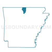
Outline

Summary
| Unique Area Identifier | 525900 |
| Name | Voting District 11-6 |
| County | Baxter County |
| State | Arkansas |
| Area (square miles) | 46.61 |
| Land Area (square miles) | 46.60 |
| Water Area (square miles) | 0.01 |
| % of Land Area | 99.97 |
| % of Water Area | 0.03 |
| Latitude of the Internal Point | 36.04070850 |
| Longtitude of the Internal Point | -92.35207170 |
Maps


Graphs
Select a template below for downloading or customizing gragh for Voting District 11-6, Baxter County, Arkansas


Neighbors
Neighoring Voting District (by Name) Neighboring Voting District on the Map
- Voting District 11-4, Baxter County, AR
- Voting District 11-5, Baxter County, AR
- Voting District 11-7, Baxter County, AR
- BIG CREEK Voting District, Marion County, AR
- Farris Voting District, Stone County, AR
- Long Creek Voting District, Searcy County, AR
- Northwest Voting District, Stone County, AR
- Roasting Ear Voting District, Stone County, AR
- Rock Creek Voting District, Searcy County, AR
Top 10 Neighboring County Subdivision (by Population) Neighboring County Subdivision on the Map
- Marion County township, Marion County, AR (16,653)
- Rock Creek township, Searcy County, AR (547)
- Long Creek township, Searcy County, AR (474)
- Northwest township, Stone County, AR (438)
- Lone Rock township, Baxter County, AR (415)
- Farris township, Stone County, AR (368)
- Big Flat township, Baxter County, AR (198)
- Greenwood township, Baxter County, AR (164)
- Roasting Ear township, Stone County, AR (149)
- Matney township, Baxter County, AR (107)
Top 10 Neighboring Place (by Population) Neighboring Place on the Map
Top 10 Neighboring Unified School District (by Population) Neighboring Unified School District on the Map
- Mountain View School District, AR (12,192)
- Flippin School District, AR (7,226)
- Searcy County School District, AR (6,747)
- Ozark Mountain School District, AR (5,101)
- Norfork Schools, AR (3,800)
- Calico Rock School District, AR (3,587)
Top 10 Neighboring State Legislative District Lower Chamber (by Population) Neighboring State Legislative District Lower Chamber on the Map
Top 10 Neighboring State Legislative District Upper Chamber (by Population) Neighboring State Legislative District Upper Chamber on the Map
- State Senate District 1, AR (84,806)
- State Senate District 2, AR (83,273)
- State Senate District 10, AR (80,214)
Top 10 Neighboring 111th Congressional District (by Population) Neighboring 111th Congressional District on the Map
Top 10 Neighboring Census Tract (by Population) Neighboring Census Tract on the Map
- Census Tract 9505, Baxter County, AR (4,962)
- Census Tract 9601, Marion County, AR (4,309)
- Census Tract 9501, Stone County, AR (4,003)
- Census Tract 9702, Searcy County, AR (3,641)
Top 10 Neighboring 5-Digit ZIP Code Tabulation Area (by Population) Neighboring 5-Digit ZIP Code Tabulation Area on the Map
- 72560, AR (8,754)
- 72634, AR (4,670)
- 72650, AR (4,362)
- 72519, AR (3,150)
- 72658, AR (1,685)
- 72639, AR (683)
- 72533, AR (416)
- 72663, AR (361)
- 72617, AR (198)